-
Administrative, Ship, Village 51.4995, -0.89912 0.74 kms (NNW) South Oxfordshire Oxfordshire South East England United Kingdom
-
Administrative, Civil Parish, Village 51.47693, -0.88639 1.92 kms (SSE) Wokingham South East England United Kingdom
-
Administrative, Civil Parish, Village 51.47359, -0.90991 2.42 kms (SSW) Wokingham South East England United Kingdom
-
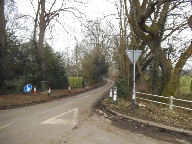
Bridge, Road Bridge, Yes 51.47575, -0.91397 2.35 kms (SSW) Eye and Dunsden South Oxfordshire Oxfordshire South East England United Kingdom
-
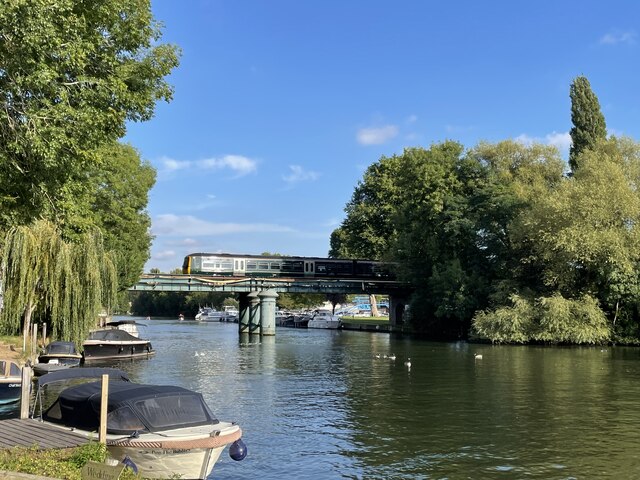
Bridge, Road Bridge 51.47667, -0.91583 2.34 kms (SW)
-
Mill, Public House, Theatre 51.47599, -0.91622 2.42 kms (SW) Eye and Dunsden South Oxfordshire Oxfordshire South East England United Kingdom
-
Marina 51.50668, -0.86984 2.3 kms (NE) Remenham Wokingham South East England United Kingdom
-
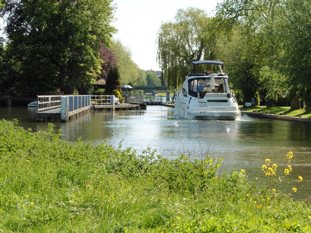
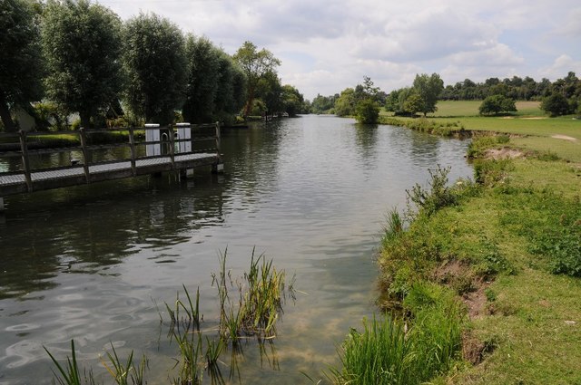
Yacht Club, Yachting 51.47511, -0.91736 2.54 kms (SW)
-
Administrative, Civil Parish, Village 51.50211, -0.86657 2.21 kms (ENE) Wokingham South East England United Kingdom
-
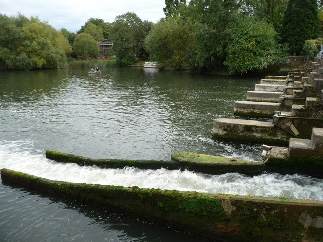
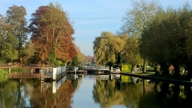
Weir 51.47349, -0.91913 2.76 kms (SW) Eye and Dunsden South Oxfordshire Oxfordshire South East England United Kingdom
-
Park 51.46358, -0.9327 4.21 kms (SW) Earley Wokingham South East England United Kingdom
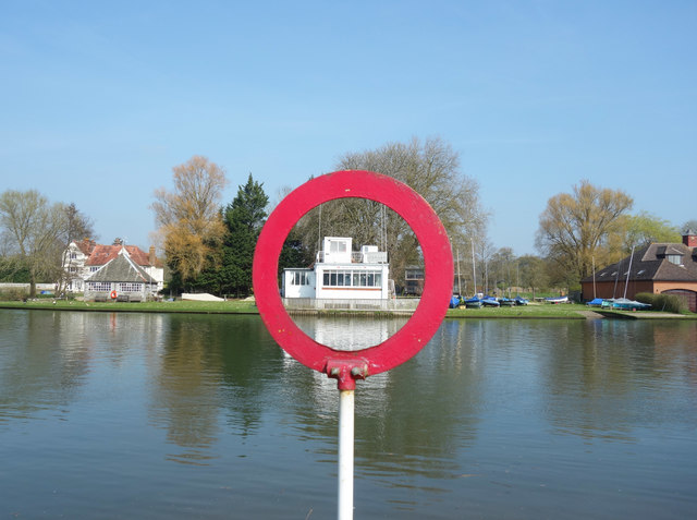
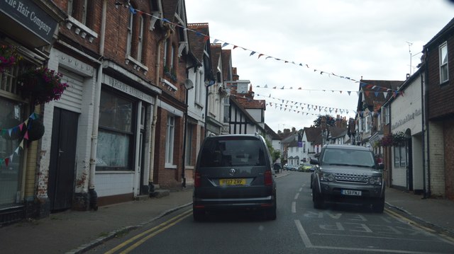
51.49331,-0.89515 14/05/2018 Dave Kelly CC BY-SA 2.0 0 kms (N)
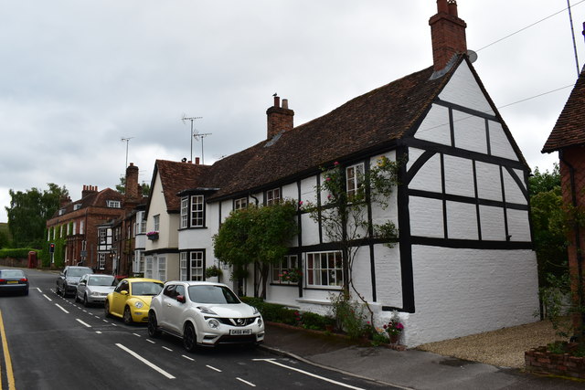
51.49456,-0.89396 05/10/2013 Christine Johnstone CC BY-SA 2.0 0.16 kms (NNE)
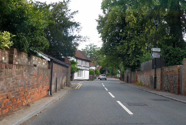
51.49239,-0.89358 18/08/2013 N Chadwick CC BY-SA 2.0 0.15 kms (SE)
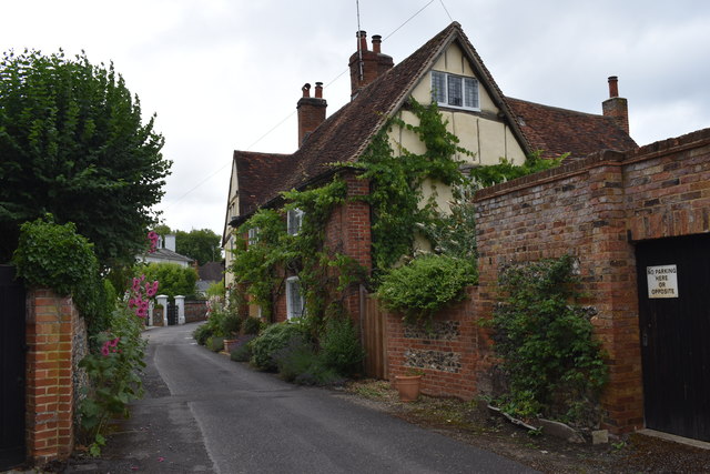
51.49464,-0.89382 18/08/2013 N Chadwick CC BY-SA 2.0 0.17 kms (NNE)
51.49511,-0.89582 18/08/2013 N Chadwick CC BY-SA 2.0 0.21 kms (NNW)
51.49491,-0.89381 03/10/2016 Des Blenkinsopp CC BY-SA 2.0 0.2 kms (NNE)
51.49529,-0.89582 03/10/2016 Des Blenkinsopp CC BY-SA 2.0 0.23 kms (NNW)
51.49114,-0.8939 05/10/2013 Christine Johnstone CC BY-SA 2.0 0.26 kms (SSE)
51.49096,-0.89405 05/10/2013 Christine Johnstone CC BY-SA 2.0 0.27 kms (SSE)
51.49653,-0.89392 17/04/2015 David Purchase CC BY-SA 2.0 0.37 kms (NNE)
51.49671,-0.89362 05/10/2013 Christine Johnstone CC BY-SA 2.0 0.39 kms (NNE)
51.49,-0.89739 17/04/2015 David Purchase CC BY-SA 2.0 0.4 kms (SSW)
51.49064,-0.89867 03/10/2016 Des Blenkinsopp CC BY-SA 2.0 0.38 kms (SW)
51.49763,-0.89605 18/08/2013 N Chadwick CC BY-SA 2.0 0.48 kms (N)
51.4979,-0.89561 03/10/2016 Des Blenkinsopp CC BY-SA 2.0 0.51 kms (N)
51.4979,-0.89604 26/09/2021 Simon Mortimer CC BY-SA 2.0 0.51 kms (N)
51.49835,-0.8956 31/10/2015 Mark Percy CC BY-SA 2.0 0.56 kms (N)
51.48802,-0.89715 05/10/2013 Christine Johnstone CC BY-SA 2.0 0.6 kms (SSW)
51.49848,-0.90006 29/10/2013 Des Blenkinsopp CC BY-SA 2.0 0.67 kms (NNW)
51.49902,-0.89025 21/07/2017 Simon Mortimer CC BY-SA 2.0 0.72 kms (NNE)
51.49787,-0.90224 29/10/2013 Des Blenkinsopp CC BY-SA 2.0 0.71 kms (NW)
51.49931,-0.90177 08/01/2018 David Howard CC BY-SA 2.0 0.81 kms (NW)
51.49949,-0.9022 08/01/2018 David Howard CC BY-SA 2.0 0.84 kms (NW)
51.50355,-0.89447 08/01/2018 David Howard CC BY-SA 2.0 1.14 kms (N)
51.50316,-0.90067 29/10/2013 Des Blenkinsopp CC BY-SA 2.0 1.16 kms (NNW)

51.50023,-0.88561 05/10/2013 Christine Johnstone CC BY-SA 2.0 1.01 kms (NE)
51.50032,-0.88561 05/10/2013 Christine Johnstone CC BY-SA 2.0 1.02 kms (NE)
51.50239,-0.88585 08/01/2018 David Howard CC BY-SA 2.0 1.2 kms (NNE)
51.50148,-0.88458 14/05/2018 Dave Kelly CC BY-SA 2.0 1.17 kms (NE)
51.50293,-0.88526 08/01/2018 David Howard CC BY-SA 2.0 1.27 kms (NNE)
51.50102,-0.88343 31/10/2015 Mark Percy CC BY-SA 2.0 1.18 kms (NE)
51.50165,-0.88385 15/07/2011 Philip Halling CC BY-SA 2.0 1.21 kms (NE)
51.49894,-0.88204 01/11/2020 Wayland Smith CC BY-SA 2.0 1.1 kms (NE)
51.50228,-0.88398 08/01/2018 David Howard CC BY-SA 2.0 1.26 kms (NE)
51.50146,-0.88285 26/09/2021 Simon Mortimer CC BY-SA 2.0 1.24 kms (NE)
51.50183,-0.88298 15/07/2011 Philip Halling CC BY-SA 2.0 1.27 kms (NE)
51.50164,-0.88284 15/07/2011 Philip Halling CC BY-SA 2.0 1.26 kms (NE)

51.50398,-0.88264 17/04/2015 David Purchase CC BY-SA 2.0 1.47 kms (NE)
51.50497,-0.88319 24/04/2010 Tim Glover CC BY-SA 2.0 1.54 kms (NNE)
51.50533,-0.88304 17/08/2013 Shazz CC BY-SA 2.0 1.58 kms (NNE)
51.5076,-0.885 17/08/2013 Shazz CC BY-SA 2.0 1.74 kms (NNE)
51.51026,-0.89056 08/01/2018 David Howard CC BY-SA 2.0 1.91 kms (N)
51.47627,-0.89066 04/07/2020 Simon Mortimer CC BY-SA 2.0 1.92 kms (S)
51.51035,-0.89056 18/08/2013 N Chadwick CC BY-SA 2.0 1.92 kms (N)

51.47573,-0.8901 18/07/2019 Lewis Clarke CC BY-SA 2.0 1.99 kms (S)
51.50768,-0.8837 08/01/2018 David Howard CC BY-SA 2.0 1.78 kms (NNE)
51.48202,-0.90968 01/11/2020 Wayland Smith CC BY-SA 2.0 1.61 kms (SW)
51.47529,-0.89097 18/07/2019 Lewis Clarke CC BY-SA 2.0 2.02 kms (S)
51.47519,-0.89011 04/07/2020 Simon Mortimer CC BY-SA 2.0 2.04 kms (S)
51.48203,-0.91025 05/10/2013 Christine Johnstone CC BY-SA 2.0 1.63 kms (SW)
51.48212,-0.91039 15/07/2011 Philip Halling CC BY-SA 2.0 1.63 kms (SW)
51.47466,-0.89185 08/01/2018 David Howard CC BY-SA 2.0 2.09 kms (S)
51.48221,-0.91054 30/04/2013 Row17 CC BY-SA 2.0 1.63 kms (SW)
51.47457,-0.89142 30/07/2017 David Howard CC BY-SA 2.0 2.1 kms (S)
51.49844,-0.87673 01/01/1970 Antony Ewart Smith CC BY-SA 2.0 1.4 kms (ENE)
51.50196,-0.87808 26/09/2021 Simon Mortimer CC BY-SA 2.0 1.52 kms (NE)
51.48195,-0.91083 08/02/2011 Derek Harper CC BY-SA 2.0 1.67 kms (SW)
51.47454,-0.89019 10/08/2001 A Rosevear CC BY-SA 2.0 2.11 kms (S)
51.47996,-0.91016 23/04/2020 Andrew Smith CC BY-SA 2.0 1.81 kms (SW)
51.48105,-0.91114 26/11/2013 Des Blenkinsopp CC BY-SA 2.0 1.76 kms (SW)
51.47979,-0.91059 08/02/2011 Derek Harper CC BY-SA 2.0 1.85 kms (SW)
51.48377,-0.91338 17/04/2015 David Purchase CC BY-SA 2.0 1.65 kms (SW)
51.51322,-0.88948 10/11/2016 Robert Eva CC BY-SA 2.0 2.25 kms (N)
51.47988,-0.91117 15/07/2011 Philip Halling CC BY-SA 2.0 1.86 kms (SW)
51.51405,-0.89162 10/11/2016 Robert Eva CC BY-SA 2.0 2.32 kms (N)
51.47371,-0.88554 23/09/2018 David Howard CC BY-SA 2.0 2.28 kms (SSE)
51.51117,-0.88247 18/09/2014 Nigel Thompson CC BY-SA 2.0 2.17 kms (NNE)
51.51144,-0.88275 14/05/2018 Dave Kelly CC BY-SA 2.0 2.19 kms (NNE)
51.51126,-0.88246 17/08/2013 Shazz CC BY-SA 2.0 2.18 kms (NNE)
51.51142,-0.88257 01/01/1970 Antony Ewart Smith CC BY-SA 2.0 2.19 kms (NNE)

51.51171,-0.88274 01/01/1970 Antony Ewart Smith CC BY-SA 2.0 2.22 kms (NNE)
51.49967,-0.87381 09/05/2019 Dave Kelly CC BY-SA 2.0 1.64 kms (ENE)
51.49967,-0.87367 01/11/2020 Wayland Smith CC BY-SA 2.0 1.65 kms (ENE)
51.51262,-0.88358 17/04/2015 David Purchase CC BY-SA 2.0 2.29 kms (NNE)
51.47664,-0.91052 01/11/2020 Wayland Smith CC BY-SA 2.0 2.14 kms (SSW)
51.5157,-0.88553 19/07/2013 Des Blenkinsopp CC BY-SA 2.0 2.58 kms (NNE)
51.47276,-0.90889 28/03/2019 Des Blenkinsopp CC BY-SA 2.0 2.48 kms (SSW)
51.51541,-0.88323 17/08/2013 Shazz CC BY-SA 2.0 2.59 kms (NNE)
51.51477,-0.88209 19/01/2012 Andrew Smith CC BY-SA 2.0 2.55 kms (NNE)
51.47276,-0.90961 28/03/2019 Des Blenkinsopp CC BY-SA 2.0 2.49 kms (SSW)
51.51003,-0.8763 27/03/2017 Des Blenkinsopp CC BY-SA 2.0 2.27 kms (NE)
51.50063,-0.87091 04/07/2020 Simon Mortimer CC BY-SA 2.0 1.86 kms (ENE)
51.49928,-0.87051 11/08/2019 Robin Webster CC BY-SA 2.0 1.83 kms (ENE)
51.50117,-0.87104 04/07/2020 Simon Mortimer CC BY-SA 2.0 1.88 kms (ENE)
51.47377,-0.91146 28/03/2019 Des Blenkinsopp CC BY-SA 2.0 2.45 kms (SSW)
51.47631,-0.91413 14/05/2018 Dave Kelly CC BY-SA 2.0 2.3 kms (SW)
51.51203,-0.87783 07/01/2015 Des Blenkinsopp CC BY-SA 2.0 2.4 kms (NNE)
51.47577,-0.91371 14/05/2018 Dave Kelly CC BY-SA 2.0 2.34 kms (SSW)
51.50234,-0.87116 26/09/2021 Simon Mortimer CC BY-SA 2.0 1.94 kms (ENE)
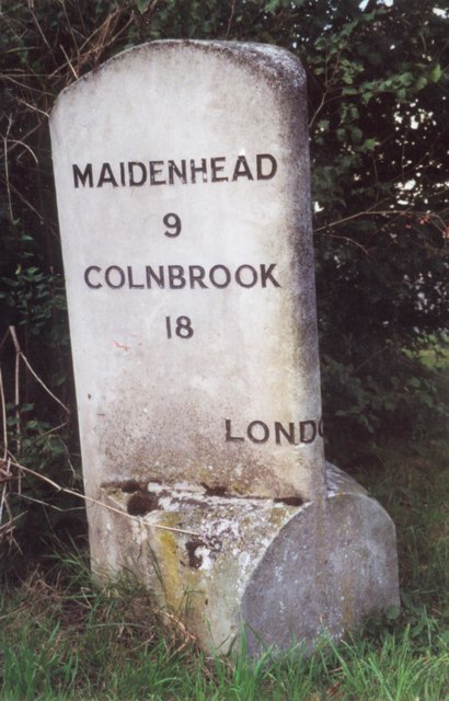
51.47564,-0.91398 01/01/1970 Milestone Society CC BY-SA 2.0 2.36 kms (SSW)
51.50288,-0.87085 04/07/2020 Simon Mortimer CC BY-SA 2.0 1.99 kms (ENE)
51.50068,-0.86996 01/11/2020 Wayland Smith CC BY-SA 2.0 1.93 kms (ENE)
51.47596,-0.91486 08/01/2018 David Howard CC BY-SA 2.0 2.36 kms (SW)
51.47533,-0.91444 01/11/2020 Wayland Smith CC BY-SA 2.0 2.4 kms (SSW)
51.50558,-0.8718 27/03/2017 Des Blenkinsopp CC BY-SA 2.0 2.12 kms (NE)
51.51694,-0.88333 15/07/2011 Philip Halling CC BY-SA 2.0 2.75 kms (NNE)
51.50113,-0.86992 01/11/2020 Wayland Smith CC BY-SA 2.0 1.95 kms (ENE)
51.51785,-0.88533 19/07/2013 Des Blenkinsopp CC BY-SA 2.0 2.81 kms (NNE)
51.47369,-0.91304 28/03/2019 Des Blenkinsopp CC BY-SA 2.0 2.51 kms (SSW)
51.51711,-0.88333 08/02/2011 Derek Harper CC BY-SA 2.0 2.77 kms (NNE)
51.50116,-0.86974 24/06/2017 N Chadwick CC BY-SA 2.0 1.96 kms (ENE)
51.50459,-0.87081 14/06/2015 Chris CC BY-SA 2.0 2.1 kms (NE)
51.51766,-0.8836 17/08/2013 Shazz CC BY-SA 2.0 2.82 kms (NNE)
51.51784,-0.88346 15/07/2011 Philip Halling CC BY-SA 2.0 2.84 kms (NNE)
51.50332,-0.86983 26/09/2021 Simon Mortimer CC BY-SA 2.0 2.08 kms (ENE)
51.46865,-0.88336 17/04/2016 N Chadwick CC BY-SA 2.0 2.86 kms (SSE)
51.46944,-0.88161 23/09/2018 David Howard CC BY-SA 2.0 2.81 kms (SSE)
51.50331,-0.8694 24/06/2017 N Chadwick CC BY-SA 2.0 2.1 kms (ENE)
51.46988,-0.88049 17/07/2016 Roger A Smith CC BY-SA 2.0 2.8 kms (SSE)
51.47897,-0.91954 26/11/2013 Des Blenkinsopp CC BY-SA 2.0 2.32 kms (SW)
51.51027,-0.87226 08/01/2015 Des Blenkinsopp CC BY-SA 2.0 2.46 kms (NE)
51.46916,-0.88004 03/06/2019 Derek Harper CC BY-SA 2.0 2.88 kms (SSE)
51.46916,-0.88004 12/08/2019 Alan Hughes CC BY-SA 2.0 2.88 kms (SSE)
51.46871,-0.88062 17/04/2016 N Chadwick CC BY-SA 2.0 2.91 kms (SSE)
51.50674,-0.86989 08/01/2015 Des Blenkinsopp CC BY-SA 2.0 2.3 kms (NE)
51.47318,-0.9155 28/03/2019 Des Blenkinsopp CC BY-SA 2.0 2.65 kms (SSW)
51.51927,-0.88284 08/02/2011 Derek Harper CC BY-SA 2.0 3.01 kms (NNE)
51.50601,-0.86919 11/08/2019 Robin Webster CC BY-SA 2.0 2.29 kms (NE)
51.47852,-0.92013 07/08/2013 Shazz CC BY-SA 2.0 2.39 kms (SW)
51.50809,-0.87015 08/01/2015 Des Blenkinsopp CC BY-SA 2.0 2.39 kms (NE)

51.47843,-0.92013 24/02/2013 David Howard CC BY-SA 2.0 2.39 kms (SW)
51.51971,-0.88197 02/04/2011 Karen Blakeman CC BY-SA 2.0 3.07 kms (NNE)
51.50726,-0.86873 28/06/2015 N Chadwick CC BY-SA 2.0 2.4 kms (NE)
51.52043,-0.88166 15/07/2011 Philip Halling CC BY-SA 2.0 3.16 kms (NNE)
51.47302,-0.9181 01/11/2020 Wayland Smith CC BY-SA 2.0 2.76 kms (SW)
51.47302,-0.91824 21/07/2017 Simon Mortimer CC BY-SA 2.0 2.76 kms (SW)
51.50635,-0.86702 14/06/2015 Chris CC BY-SA 2.0 2.43 kms (NE)
51.47294,-0.9194 28/03/2019 Des Blenkinsopp CC BY-SA 2.0 2.82 kms (SW)
51.47231,-0.91898 14/05/2018 Dave Kelly CC BY-SA 2.0 2.86 kms (SW)
51.50571,-0.86589 18/06/2017 Chris CC BY-SA 2.0 2.45 kms (NE)
51.50571,-0.86589 18/06/2017 Chris CC BY-SA 2.0 2.45 kms (NE)
51.52149,-0.88034 30/04/2013 Row17 CC BY-SA 2.0 3.3 kms (NNE)
51.51104,-0.86849 24/09/2015 Steve Daniels CC BY-SA 2.0 2.7 kms (NE)
51.52166,-0.87861 17/04/2015 David Purchase CC BY-SA 2.0 3.35 kms (NNE)
51.51755,-0.8728 18/06/2017 Chris CC BY-SA 2.0 3.11 kms (NNE)
51.51446,-0.86941 24/09/2015 Steve Daniels CC BY-SA 2.0 2.95 kms (NE)
51.51817,-0.87177 11/08/2019 Robin Webster CC BY-SA 2.0 3.2 kms (NNE)
51.51499,-0.86782 24/03/2012 Stuart Logan CC BY-SA 2.0 3.06 kms (NE)
51.52766,-0.88552 08/08/2019 Steve Daniels CC BY-SA 2.0 3.88 kms (N)
51.5281,-0.88508 08/08/2019 Steve Daniels CC BY-SA 2.0 3.93 kms (N)
51.52847,-0.88608 08/08/2019 Steve Daniels CC BY-SA 2.0 3.96 kms (N)
51.52847,-0.88608 08/08/2019 Steve Daniels CC BY-SA 2.0 3.96 kms (N)
51.5215,-0.87212 07/01/2015 Des Blenkinsopp CC BY-SA 2.0 3.52 kms (NNE)
51.51977,-0.87 08/04/2008 Andrew Smith CC BY-SA 2.0 3.42 kms (NNE)
51.52865,-0.88593 08/08/2019 Steve Daniels CC BY-SA 2.0 3.98 kms (N)
51.52856,-0.8855 08/08/2019 Steve Daniels CC BY-SA 2.0 3.98 kms (N)
51.52865,-0.8855 08/08/2019 Steve Daniels CC BY-SA 2.0 3.99 kms (N)
51.52911,-0.88693 08/08/2019 Steve Daniels CC BY-SA 2.0 4.02 kms (N)
51.52883,-0.88578 08/08/2019 Steve Daniels CC BY-SA 2.0 4 kms (N)
51.52901,-0.8865 08/08/2019 Steve Daniels CC BY-SA 2.0 4.01 kms (N)
51.51741,-0.86732 24/03/2012 Stuart Logan CC BY-SA 2.0 3.3 kms (NE)
51.52929,-0.88707 08/08/2019 Steve Daniels CC BY-SA 2.0 4.04 kms (N)
51.52965,-0.88677 08/08/2019 Steve Daniels CC BY-SA 2.0 4.08 kms (N)
51.51904,-0.868 24/03/2012 Stuart Logan CC BY-SA 2.0 3.42 kms (NNE)
51.51522,-0.86435 18/11/2005 Andrew Smith CC BY-SA 2.0 3.24 kms (NE)
51.51468,-0.86393 17/08/2013 Shazz CC BY-SA 2.0 3.21 kms (NE)
51.52157,-0.86996 08/04/2008 Andrew Smith CC BY-SA 2.0 3.59 kms (NNE)
51.46686,-0.92242 06/06/2009 Tim Glover CC BY-SA 2.0 3.5 kms (SSW)
51.53158,-0.89119 08/08/2019 Steve Daniels CC BY-SA 2.0 4.26 kms (N)
51.51975,-0.86712 16/08/2007 Andrew Smith CC BY-SA 2.0 3.52 kms (NNE)
51.46687,-0.924 01/11/2020 Wayland Smith CC BY-SA 2.0 3.55 kms (SW)
51.52154,-0.86708 19/11/2005 Andrew Smith CC BY-SA 2.0 3.69 kms (NNE)
51.51918,-0.86469 17/08/2013 Shazz CC BY-SA 2.0 3.57 kms (NE)
51.51891,-0.86426 24/03/2012 Stuart Logan CC BY-SA 2.0 3.56 kms (NE)
51.46498,-0.92376 07/03/2014 Des Blenkinsopp CC BY-SA 2.0 3.72 kms (SSW)
51.46553,-0.92461 07/03/2014 Des Blenkinsopp CC BY-SA 2.0 3.7 kms (SSW)
51.46708,-0.9276 19/12/2017 Andrew Smith CC BY-SA 2.0 3.68 kms (SW)
51.46709,-0.92875 01/11/2020 Wayland Smith CC BY-SA 2.0 3.73 kms (SW)
51.46038,-0.92228 29/03/2015 N Chadwick CC BY-SA 2.0 4.12 kms (SSW)
51.4603,-0.92272 08/05/2016 N Chadwick CC BY-SA 2.0 4.14 kms (SSW)
51.4615,-0.92643 02/03/1956 norman griffin CC BY-SA 2.0 4.15 kms (SSW)
51.46168,-0.92715 15/06/2014 Chris CC BY-SA 2.0 4.16 kms (SSW)
51.46605,-0.93223 18/04/2015 David Purchase CC BY-SA 2.0 3.97 kms (SW)
51.46841,-0.93476 18/06/2017 Rose and Trev Clough CC BY-SA 2.0 3.9 kms (SW)
51.46454,-0.935 06/10/2013 Christine Johnstone CC BY-SA 2.0 4.22 kms (SW)
51.46084,-0.93321 07/03/2014 Des Blenkinsopp CC BY-SA 2.0 4.47 kms (SW)
51.46104,-0.93508 03/11/2014 Roger Templeman CC BY-SA 2.0 4.53 kms (SW)