-
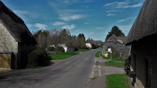
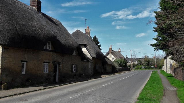
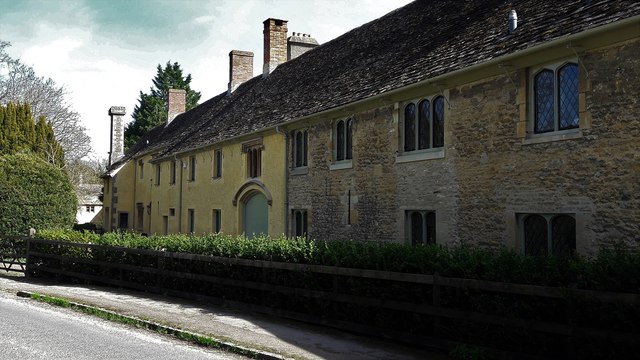
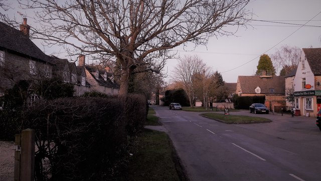
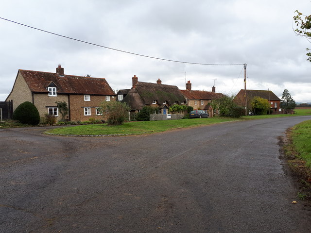
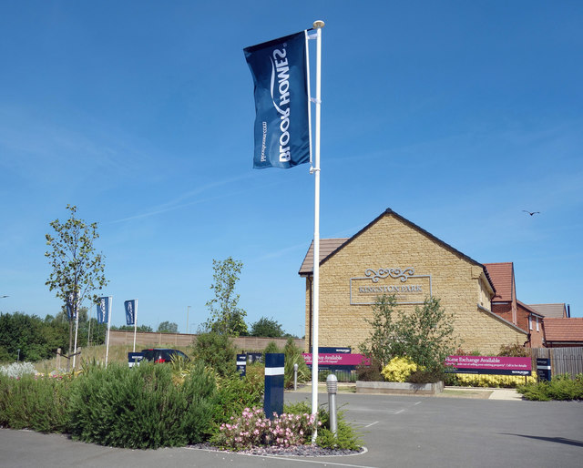
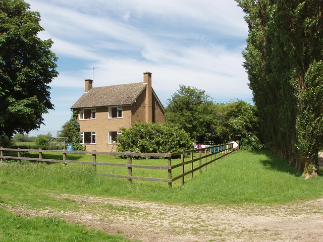
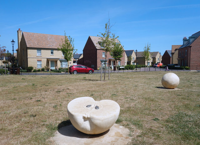
Administrative, Civil Parish, Village 51.72251, -1.3921 0.07 kms (WSW) Northmoor West Oxfordshire Oxfordshire South East England United Kingdom
-
Camp Site 51.71516, -1.37707 1.28 kms (SE) Appleton-with-Eaton Vale of White Horse Oxfordshire South East England United Kingdom
-
Administrative, Hamlet 51.71071, -1.40587 1.67 kms (SW) Northmoor West Oxfordshire Oxfordshire South East England United Kingdom
-
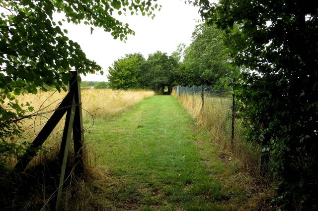
Wood 51.71912, -1.37167 1.4 kms (ESE) Appleton-with-Eaton Vale of White Horse Oxfordshire South East England United Kingdom
-
Car, Caravan-site, Park, Residential 51.73489, -1.37536 1.74 kms (NE) Northmoor West Oxfordshire Oxfordshire South East England United Kingdom
-
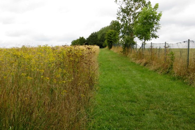
Wood 51.71723, -1.37107 1.51 kms (ESE) Appleton-with-Eaton Vale of White Horse Oxfordshire South East England United Kingdom
-
Hamlet, Populated Place 51.73467, -1.37311 1.82 kms (NE) Northmoor West Oxfordshire Oxfordshire South East England United Kingdom
-
Wood 51.72206, -1.36905 1.53 kms (E) Appleton-with-Eaton Vale of White Horse Oxfordshire South East England United Kingdom
-
Car, Caravan-site, Park 51.73893, -1.37362 2.17 kms (NNE) Appleton-with-Eaton Vale of White Horse Oxfordshire South East England United Kingdom
-
Administrative, Civil Parish, Village 51.74796, -1.40395 2.94 kms (NNW) Stanton Harcourt West Oxfordshire Oxfordshire South East England United Kingdom
-
Pub 51.71032, -1.41679 2.24 kms (SW) Northmoor West Oxfordshire Oxfordshire South East England United Kingdom
-
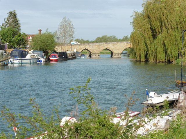
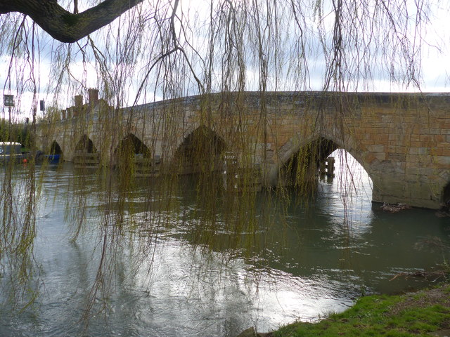
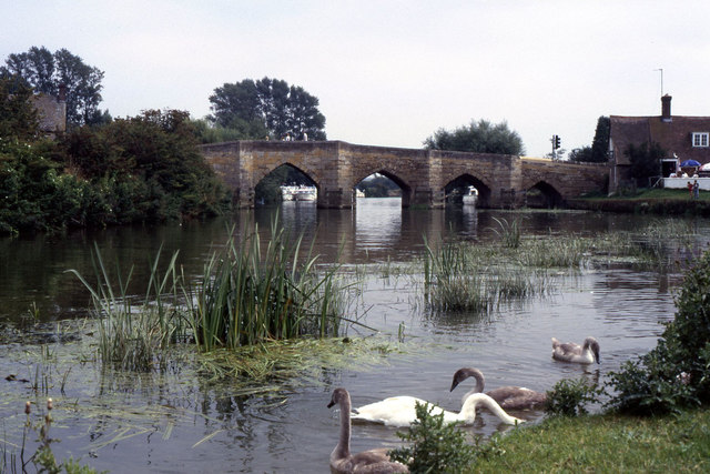
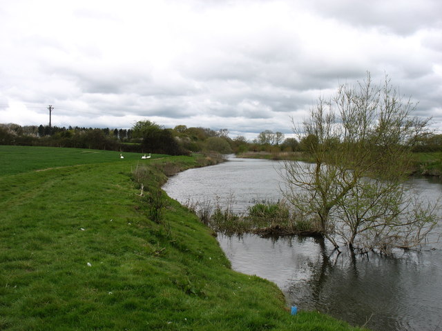
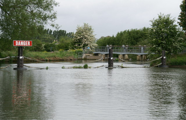
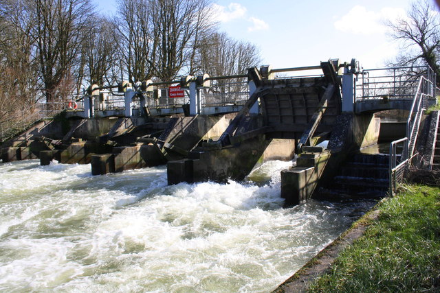
River, Road Bridge 51.71, -1.41722 2.28 kms (SW)
-
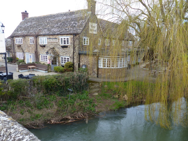
House, Pub, Public, Public House 51.70961, -1.41741 2.32 kms (SW)
-
Village 51.70982, -1.36278 2.43 kms (SE) Vale of White Horse Oxfordshire South East England United Kingdom
-
Administrative, Civil Parish, Village 51.72716, -1.42416 2.32 kms (WNW) West Oxfordshire Oxfordshire South East England United Kingdom
-
Village 51.68723, -1.39151 3.94 kms (S) Vale of White Horse Oxfordshire South East England United Kingdom
-
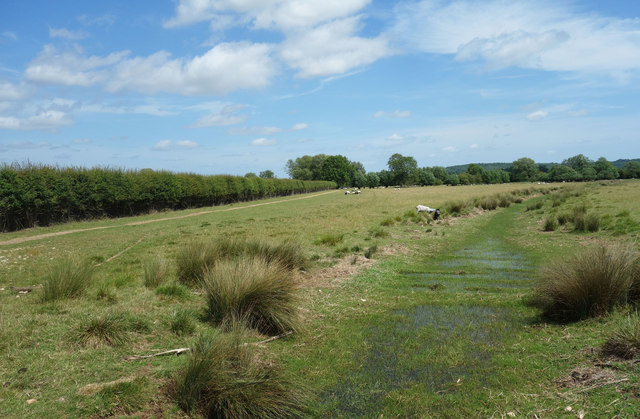
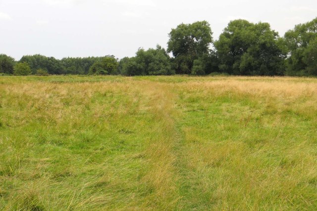
Meadow, Nature Reserve 51.74927, -1.36638 3.41 kms (NNE) Stanton Harcourt West Oxfordshire Oxfordshire South East England United Kingdom
-
Farm 51.74513, -1.36228 3.19 kms (NE) Vale of White Horse Oxfordshire South East England United Kingdom
-
Meadow, Nature Reserve 51.75158, -1.36585 3.65 kms (NNE) Stanton Harcourt West Oxfordshire Oxfordshire South East England United Kingdom
-
Meadow, Nature Reserve 51.75714, -1.36434 4.25 kms (NNE) Stanton Harcourt West Oxfordshire Oxfordshire South East England United Kingdom
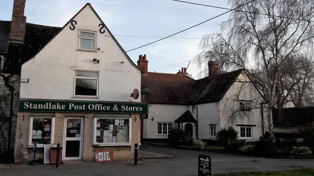
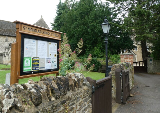
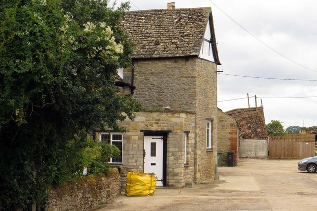
51.72271,-1.3912 01/02/2018 Chris Brown CC BY-SA 2.0 0 kms (N)
51.72253,-1.39135 19/02/2017 Chris Brown CC BY-SA 2.0 0.02 kms (SSW)
51.72271,-1.39163 01/02/2018 Chris Brown CC BY-SA 2.0 0.03 kms (W)
51.72298,-1.39178 19/02/2017 Chris Brown CC BY-SA 2.0 0.05 kms (NW)
51.72289,-1.39207 19/02/2017 Chris Brown CC BY-SA 2.0 0.06 kms (WNW)
51.72298,-1.39206 19/02/2017 Chris Brown CC BY-SA 2.0 0.07 kms (WNW)
51.72387,-1.39046 01/02/2018 Chris Brown CC BY-SA 2.0 0.14 kms (NNE)
51.72396,-1.38988 20/09/2020 Des Blenkinsopp CC BY-SA 2.0 0.17 kms (NNE)
51.7229,-1.39308 25/02/2017 Nigel Mykura CC BY-SA 2.0 0.13 kms (W)
51.72299,-1.39322 19/02/2017 Chris Brown CC BY-SA 2.0 0.14 kms (WNW)
51.71858,-1.39256 20/09/2020 Des Blenkinsopp CC BY-SA 2.0 0.47 kms (S)
51.72257,-1.38237 27/02/2017 Nigel Mykura CC BY-SA 2.0 0.61 kms (E)
51.71264,-1.39235 20/09/2020 Des Blenkinsopp CC BY-SA 2.0 1.12 kms (S)
51.71227,-1.39004 20/09/2020 Des Blenkinsopp CC BY-SA 2.0 1.16 kms (S)
51.72119,-1.37703 20/09/2020 Des Blenkinsopp CC BY-SA 2.0 0.99 kms (E)
51.7099,-1.38471 28/05/2011 Philip Halling CC BY-SA 2.0 1.49 kms (SSE)
51.71303,-1.38047 28/05/2011 Philip Halling CC BY-SA 2.0 1.31 kms (SE)
51.71267,-1.38077 28/05/2011 Philip Halling CC BY-SA 2.0 1.33 kms (SSE)
51.71294,-1.38048 27/02/2017 Nigel Mykura CC BY-SA 2.0 1.31 kms (SE)
51.71294,-1.38033 04/02/2016 Roger Templeman CC BY-SA 2.0 1.32 kms (SE)
51.71303,-1.38018 04/02/2016 Roger Templeman CC BY-SA 2.0 1.32 kms (SE)
51.70981,-1.38414 24/04/2016 David Purchase CC BY-SA 2.0 1.51 kms (SSE)
51.70865,-1.38632 28/05/2011 Philip Halling CC BY-SA 2.0 1.6 kms (SSE)
51.71222,-1.38034 06/09/2016 Vieve Forward CC BY-SA 2.0 1.39 kms (SSE)
51.70786,-1.38836 28/05/2011 Philip Halling CC BY-SA 2.0 1.66 kms (S)
51.71625,-1.37739 28/05/2011 Philip Halling CC BY-SA 2.0 1.19 kms (SE)
51.71607,-1.37725 27/02/2017 Nigel Mykura CC BY-SA 2.0 1.21 kms (SE)
51.71625,-1.37696 06/05/2013 Dave Price CC BY-SA 2.0 1.22 kms (SE)
51.71297,-1.40349 02/03/2017 Des Blenkinsopp CC BY-SA 2.0 1.37 kms (SW)
51.71634,-1.37681 27/02/2017 Nigel Mykura CC BY-SA 2.0 1.22 kms (SE)
51.7068,-1.39301 11/05/2018 Dave Kelly CC BY-SA 2.0 1.77 kms (S)
51.71624,-1.37652 24/04/2016 David Purchase CC BY-SA 2.0 1.24 kms (SE)
51.71642,-1.37638 19/08/2010 Mike Todd CC BY-SA 2.0 1.24 kms (SE)
51.70653,-1.39243 28/05/2011 Philip Halling CC BY-SA 2.0 1.8 kms (S)
51.70662,-1.39344 04/02/2016 Roger Templeman CC BY-SA 2.0 1.79 kms (S)
51.70663,-1.39445 06/09/2016 Vieve Forward CC BY-SA 2.0 1.8 kms (S)
51.71705,-1.37579 11/05/2018 Dave Kelly CC BY-SA 2.0 1.23 kms (ESE)
51.71678,-1.37565 28/05/2011 Philip Halling CC BY-SA 2.0 1.26 kms (ESE)
51.70636,-1.39533 24/04/2016 David Purchase CC BY-SA 2.0 1.84 kms (S)
51.70599,-1.3936 27/02/2017 Nigel Mykura CC BY-SA 2.0 1.87 kms (S)
51.73361,-1.37817 24/04/2016 David Purchase CC BY-SA 2.0 1.51 kms (NE)
51.70664,-1.3972 11/05/2018 Dave Kelly CC BY-SA 2.0 1.83 kms (SSW)
51.71235,-1.40509 02/03/2017 Des Blenkinsopp CC BY-SA 2.0 1.5 kms (SW)
51.71686,-1.37478 06/09/2016 Vieve Forward CC BY-SA 2.0 1.3 kms (ESE)
51.70518,-1.39245 16/07/2019 Vieve Forward CC BY-SA 2.0 1.95 kms (S)
51.71118,-1.40539 11/03/2014 Steve Daniels CC BY-SA 2.0 1.61 kms (SW)
51.70738,-1.40139 28/05/2011 Philip Halling CC BY-SA 2.0 1.84 kms (SSW)
51.70775,-1.40269 04/02/2016 Roger Templeman CC BY-SA 2.0 1.84 kms (SSW)
51.70775,-1.40269 04/02/2016 Roger Templeman CC BY-SA 2.0 1.84 kms (SSW)
51.71946,-1.37242 28/05/2011 Philip Halling CC BY-SA 2.0 1.34 kms (ESE)
51.70365,-1.3929 28/05/2011 Philip Halling CC BY-SA 2.0 2.12 kms (S)
51.70775,-1.40327 28/05/2011 Philip Halling CC BY-SA 2.0 1.86 kms (SSW)
51.71019,-1.40599 11/03/2014 Steve Daniels CC BY-SA 2.0 1.72 kms (SW)
51.70328,-1.39074 30/12/2009 Shaun Ferguson CC BY-SA 2.0 2.16 kms (S)
51.7101,-1.40599 04/02/2016 Roger Templeman CC BY-SA 2.0 1.73 kms (SW)
51.7101,-1.40613 04/02/2016 Roger Templeman CC BY-SA 2.0 1.74 kms (SW)
51.70812,-1.40471 28/05/2011 Philip Halling CC BY-SA 2.0 1.87 kms (SSW)
51.72089,-1.37125 27/02/2017 Nigel Mykura CC BY-SA 2.0 1.39 kms (E)
51.70485,-1.38102 05/03/2015 Des Blenkinsopp CC BY-SA 2.0 2.11 kms (SSE)
51.70203,-1.39249 25/04/2010 Bill Nicholls CC BY-SA 2.0 2.3 kms (S)

51.73466,-1.37381 28/05/2016 P L Chadwick CC BY-SA 2.0 1.79 kms (NE)
51.73466,-1.37381 28/05/2016 P L Chadwick CC BY-SA 2.0 1.79 kms (NE)
51.70894,-1.40774 28/05/2011 Philip Halling CC BY-SA 2.0 1.91 kms (SW)
51.73475,-1.37337 28/05/2016 P L Chadwick CC BY-SA 2.0 1.82 kms (NE)
51.73718,-1.37464 06/09/2016 Vieve Forward CC BY-SA 2.0 1.97 kms (NE)
51.70048,-1.38788 25/04/2010 Bill Nicholls CC BY-SA 2.0 2.48 kms (S)
51.73501,-1.37235 28/05/2016 P L Chadwick CC BY-SA 2.0 1.89 kms (NE)
51.70868,-1.40904 28/05/2011 Philip Halling CC BY-SA 2.0 1.99 kms (SW)
51.73501,-1.37206 28/05/2016 P L Chadwick CC BY-SA 2.0 1.9 kms (NE)
51.70021,-1.38745 25/04/2010 Bill Nicholls CC BY-SA 2.0 2.51 kms (S)
51.73501,-1.37192 28/05/2016 P L Chadwick CC BY-SA 2.0 1.91 kms (NE)
51.73501,-1.37192 01/03/2017 Nigel Mykura CC BY-SA 2.0 1.91 kms (NE)
51.73528,-1.37163 28/05/2016 P L Chadwick CC BY-SA 2.0 1.94 kms (NE)
51.73519,-1.37148 01/12/2015 Roger Templeman CC BY-SA 2.0 1.94 kms (NE)
51.73438,-1.37092 01/03/2017 Nigel Mykura CC BY-SA 2.0 1.91 kms (NE)
51.70064,-1.38339 27/06/2013 Des Blenkinsopp CC BY-SA 2.0 2.51 kms (SSE)
51.69973,-1.38297 03/09/2013 Steve Daniels CC BY-SA 2.0 2.62 kms (SSE)
51.74639,-1.39928 25/03/2017 Chris Brown CC BY-SA 2.0 2.69 kms (NNW)
51.69804,-1.38647 25/04/2010 Bill Nicholls CC BY-SA 2.0 2.76 kms (S)
51.69901,-1.3824 03/09/2013 Steve Daniels CC BY-SA 2.0 2.7 kms (SSE)
51.69892,-1.3824 04/02/2016 Roger Templeman CC BY-SA 2.0 2.71 kms (SSE)
51.69875,-1.38284 03/09/2013 Steve Daniels CC BY-SA 2.0 2.73 kms (SSE)
51.69847,-1.3827 27/06/2013 Des Blenkinsopp CC BY-SA 2.0 2.76 kms (SSE)
51.74738,-1.39869 25/03/2017 Chris Brown CC BY-SA 2.0 2.79 kms (N)
51.74747,-1.39883 25/03/2017 Chris Brown CC BY-SA 2.0 2.8 kms (N)
51.74792,-1.39781 25/03/2017 Chris Brown CC BY-SA 2.0 2.84 kms (N)
51.74783,-1.39825 25/03/2017 Chris Brown CC BY-SA 2.0 2.84 kms (N)
51.748,-1.39767 25/03/2017 Chris Brown CC BY-SA 2.0 2.85 kms (N)
51.748,-1.39767 25/03/2017 Chris Brown CC BY-SA 2.0 2.85 kms (N)
51.74783,-1.39839 25/03/2017 Chris Brown CC BY-SA 2.0 2.84 kms (N)
51.748,-1.39781 25/03/2017 Chris Brown CC BY-SA 2.0 2.85 kms (N)
51.748,-1.39781 25/03/2017 Chris Brown CC BY-SA 2.0 2.85 kms (N)
51.74757,-1.39985 25/03/2017 Chris Brown CC BY-SA 2.0 2.83 kms (NNW)
51.74784,-1.39984 25/03/2017 Chris Brown CC BY-SA 2.0 2.86 kms (NNW)
51.74819,-1.39911 25/03/2017 Chris Brown CC BY-SA 2.0 2.89 kms (N)
51.70979,-1.41525 11/05/2018 Dave Kelly CC BY-SA 2.0 2.19 kms (SW)
51.70898,-1.41526 02/03/2017 Des Blenkinsopp CC BY-SA 2.0 2.25 kms (SW)
51.74691,-1.37755 22/06/2020 Des Blenkinsopp CC BY-SA 2.0 2.85 kms (NNE)
51.74937,-1.40142 25/03/2017 Chris Brown CC BY-SA 2.0 3.05 kms (NNW)
51.71016,-1.41699 02/03/2017 Des Blenkinsopp CC BY-SA 2.0 2.26 kms (SW)
51.71007,-1.41699 17/03/2019 Ruth Sharville CC BY-SA 2.0 2.26 kms (SW)
51.7479,-1.37696 22/06/2020 Des Blenkinsopp CC BY-SA 2.0 2.97 kms (NNE)
51.7098,-1.41713 17/03/2019 Ruth Sharville CC BY-SA 2.0 2.29 kms (SW)
51.70989,-1.41728 30/08/1987 Colin Park CC BY-SA 2.0 2.29 kms (SW)
51.71016,-1.41742 21/05/2011 Philip Halling CC BY-SA 2.0 2.28 kms (SW)
51.71016,-1.41742 21/05/2011 Philip Halling CC BY-SA 2.0 2.28 kms (SW)
51.7098,-1.41728 22/08/2020 Robin Webster CC BY-SA 2.0 2.3 kms (SW)
51.70998,-1.41757 17/03/2019 Ruth Sharville CC BY-SA 2.0 2.3 kms (SW)
51.7098,-1.41757 01/01/1970 Des Blenkinsopp CC BY-SA 2.0 2.31 kms (SW)
51.70953,-1.41801 02/03/2017 Des Blenkinsopp CC BY-SA 2.0 2.36 kms (SW)
51.74652,-1.37234 24/04/2016 David Purchase CC BY-SA 2.0 2.95 kms (NNE)
51.74895,-1.40722 25/03/2017 Chris Brown CC BY-SA 2.0 3.12 kms (NNW)
51.72682,-1.42271 30/05/2021 Vieve Forward CC BY-SA 2.0 2.22 kms (W)
51.7271,-1.42459 22/07/2014 Des Blenkinsopp CC BY-SA 2.0 2.35 kms (W)
51.71379,-1.42389 04/02/2016 Roger Templeman CC BY-SA 2.0 2.46 kms (WSW)
51.71406,-1.42432 30/05/2021 Vieve Forward CC BY-SA 2.0 2.48 kms (WSW)
51.72602,-1.42532 24/02/2017 Chris Brown CC BY-SA 2.0 2.38 kms (W)
51.71094,-1.35894 31/07/2021 Basher Eyre CC BY-SA 2.0 2.58 kms (ESE)
51.71094,-1.35894 31/07/2021 Basher Eyre CC BY-SA 2.0 2.58 kms (ESE)
51.71094,-1.35894 31/07/2021 Basher Eyre CC BY-SA 2.0 2.58 kms (ESE)
51.71094,-1.35894 31/07/2021 Basher Eyre CC BY-SA 2.0 2.58 kms (ESE)
51.71094,-1.35894 31/07/2021 Basher Eyre CC BY-SA 2.0 2.58 kms (ESE)
51.71094,-1.35894 31/07/2021 Basher Eyre CC BY-SA 2.0 2.58 kms (ESE)
51.71094,-1.35894 31/07/2021 Basher Eyre CC BY-SA 2.0 2.58 kms (ESE)
51.71094,-1.35894 31/07/2021 Basher Eyre CC BY-SA 2.0 2.58 kms (ESE)
51.71094,-1.35894 31/07/2021 Basher Eyre CC BY-SA 2.0 2.58 kms (ESE)
51.71094,-1.35894 31/07/2021 Basher Eyre CC BY-SA 2.0 2.58 kms (ESE)
51.71094,-1.35894 31/07/2021 Basher Eyre CC BY-SA 2.0 2.58 kms (ESE)
51.71094,-1.35894 31/07/2021 Basher Eyre CC BY-SA 2.0 2.58 kms (ESE)
51.71094,-1.35894 31/07/2021 Basher Eyre CC BY-SA 2.0 2.58 kms (ESE)
51.71094,-1.35894 31/07/2021 Basher Eyre CC BY-SA 2.0 2.58 kms (ESE)
51.71094,-1.35894 31/07/2021 Basher Eyre CC BY-SA 2.0 2.58 kms (ESE)
51.72576,-1.42547 24/02/2017 Chris Brown CC BY-SA 2.0 2.38 kms (W)
51.74613,-1.36568 17/08/2013 Steve Daniels CC BY-SA 2.0 3.14 kms (NE)
51.73106,-1.42483 22/07/2014 Des Blenkinsopp CC BY-SA 2.0 2.5 kms (WNW)
51.72998,-1.42542 13/06/2013 Steve Daniels CC BY-SA 2.0 2.49 kms (WNW)
51.7298,-1.42557 22/07/2014 Des Blenkinsopp CC BY-SA 2.0 2.49 kms (WNW)
51.73007,-1.42556 13/06/2013 Steve Daniels CC BY-SA 2.0 2.5 kms (WNW)
51.72998,-1.42585 13/06/2013 Steve Daniels CC BY-SA 2.0 2.52 kms (WNW)
51.74838,-1.36666 06/09/2016 Vieve Forward CC BY-SA 2.0 3.32 kms (NNE)
51.68718,-1.38893 31/07/2021 Basher Eyre CC BY-SA 2.0 3.95 kms (S)
51.68718,-1.38893 31/07/2021 Basher Eyre CC BY-SA 2.0 3.95 kms (S)
51.68718,-1.38893 31/07/2021 Basher Eyre CC BY-SA 2.0 3.95 kms (S)
51.68718,-1.38893 31/07/2021 Basher Eyre CC BY-SA 2.0 3.95 kms (S)
51.68718,-1.38893 31/07/2021 Basher Eyre CC BY-SA 2.0 3.95 kms (S)
51.68718,-1.38893 31/07/2021 Basher Eyre CC BY-SA 2.0 3.95 kms (S)
51.68718,-1.38893 31/07/2021 Basher Eyre CC BY-SA 2.0 3.95 kms (S)
51.68718,-1.38893 31/07/2021 Basher Eyre CC BY-SA 2.0 3.95 kms (S)
51.68709,-1.38965 31/07/2021 Basher Eyre CC BY-SA 2.0 3.96 kms (S)
51.72495,-1.42679 24/02/2017 Chris Brown CC BY-SA 2.0 2.46 kms (W)
51.72989,-1.42614 24/02/2017 Chris Brown CC BY-SA 2.0 2.54 kms (WNW)
51.74684,-1.3648 17/08/2013 Steve Daniels CC BY-SA 2.0 3.24 kms (NE)
51.687,-1.38879 31/07/2021 Basher Eyre CC BY-SA 2.0 3.97 kms (S)
51.7299,-1.42629 24/02/2017 Chris Brown CC BY-SA 2.0 2.55 kms (WNW)
51.7299,-1.42629 13/06/2013 Steve Daniels CC BY-SA 2.0 2.55 kms (WNW)
51.74512,-1.36294 17/08/2013 Steve Daniels CC BY-SA 2.0 3.16 kms (NE)
51.74892,-1.36608 17/08/2013 Steve Daniels CC BY-SA 2.0 3.39 kms (NNE)
51.70966,-1.42524 21/05/2011 Philip Halling CC BY-SA 2.0 2.76 kms (WSW)
51.7481,-1.36493 17/08/2013 Steve Daniels CC BY-SA 2.0 3.35 kms (NNE)
51.74846,-1.36522 17/08/2013 Steve Daniels CC BY-SA 2.0 3.38 kms (NNE)
51.74846,-1.36522 17/08/2013 Steve Daniels CC BY-SA 2.0 3.38 kms (NNE)
51.68601,-1.38865 31/07/2021 Basher Eyre CC BY-SA 2.0 4.08 kms (S)
51.75027,-1.36678 17/08/2013 Steve Daniels CC BY-SA 2.0 3.5 kms (NNE)
51.68558,-1.39358 31/07/2021 Basher Eyre CC BY-SA 2.0 4.13 kms (S)
51.74539,-1.36164 17/08/2013 Steve Daniels CC BY-SA 2.0 3.24 kms (NE)
51.70948,-1.42626 10/05/2018 Dave Kelly CC BY-SA 2.0 2.83 kms (WSW)
51.74575,-1.36149 17/08/2013 Steve Daniels CC BY-SA 2.0 3.28 kms (NE)
51.70949,-1.4264 05/09/2012 Shaun Ferguson CC BY-SA 2.0 2.84 kms (WSW)
51.74538,-1.36048 17/08/2013 Steve Daniels CC BY-SA 2.0 3.29 kms (NE)
51.75026,-1.36461 17/08/2013 Steve Daniels CC BY-SA 2.0 3.57 kms (NNE)
51.75008,-1.36418 17/08/2013 Steve Daniels CC BY-SA 2.0 3.57 kms (NNE)
51.75278,-1.36617 26/02/2017 Nigel Mykura CC BY-SA 2.0 3.76 kms (NNE)
51.6835,-1.39057 01/11/2019 Vieve Forward CC BY-SA 2.0 4.36 kms (S)
51.74492,-1.35773 17/08/2013 Steve Daniels CC BY-SA 2.0 3.38 kms (NE)
51.74454,-1.35571 17/08/2013 Steve Daniels CC BY-SA 2.0 3.45 kms (NE)
51.70879,-1.43061 25/04/2016 David Purchase CC BY-SA 2.0 3.12 kms (WSW)
51.70852,-1.43076 28/10/2009 Chris Gunns CC BY-SA 2.0 3.15 kms (WSW)
51.75538,-1.36454 17/08/2013 Steve Daniels CC BY-SA 2.0 4.07 kms (NNE)
51.75493,-1.36397 17/08/2013 Steve Daniels CC BY-SA 2.0 4.04 kms (NNE)
51.75538,-1.36439 17/08/2013 Steve Daniels CC BY-SA 2.0 4.08 kms (NNE)
51.75638,-1.36554 17/08/2013 Steve Daniels CC BY-SA 2.0 4.14 kms (NNE)
51.7087,-1.43119 21/05/2011 Philip Halling CC BY-SA 2.0 3.16 kms (WSW)
51.75493,-1.36368 26/02/2017 Nigel Mykura CC BY-SA 2.0 4.05 kms (NNE)
51.74427,-1.3547 17/08/2013 Steve Daniels CC BY-SA 2.0 3.47 kms (NE)
51.70708,-1.43063 06/05/2013 Dave Price CC BY-SA 2.0 3.22 kms (WSW)
51.75574,-1.36453 17/08/2013 Steve Daniels CC BY-SA 2.0 4.11 kms (NNE)
51.68386,-1.4085 28/05/2020 Des Blenkinsopp CC BY-SA 2.0 4.48 kms (SSW)
51.75628,-1.36496 17/08/2013 Steve Daniels CC BY-SA 2.0 4.15 kms (NNE)
51.75746,-1.36654 11/05/2018 Dave Kelly CC BY-SA 2.0 4.22 kms (NNE)
51.74427,-1.35441 17/08/2013 Steve Daniels CC BY-SA 2.0 3.49 kms (NE)
51.68568,-1.41267 10/08/2019 David Howard CC BY-SA 2.0 4.37 kms (SSW)
51.74418,-1.35412 17/08/2013 Steve Daniels CC BY-SA 2.0 3.5 kms (NE)
51.68568,-1.41282 10/08/2019 David Howard CC BY-SA 2.0 4.38 kms (SSW)
51.68378,-1.40922 28/05/2020 Des Blenkinsopp CC BY-SA 2.0 4.5 kms (SSW)
51.75719,-1.36553 17/08/2013 Steve Daniels CC BY-SA 2.0 4.22 kms (NNE)
51.75791,-1.36639 24/04/2016 David Purchase CC BY-SA 2.0 4.27 kms (NNE)
51.758,-1.36639 17/08/2013 Steve Daniels CC BY-SA 2.0 4.28 kms (NNE)
51.76099,-1.37084 22/05/2007 David Hawgood CC BY-SA 2.0 4.48 kms (NNE)
51.74399,-1.3534 17/08/2013 Steve Daniels CC BY-SA 2.0 3.52 kms (NE)
51.75827,-1.36609 17/08/2013 Steve Daniels CC BY-SA 2.0 4.32 kms (NNE)
51.68397,-1.41139 28/05/2020 Des Blenkinsopp CC BY-SA 2.0 4.53 kms (SSW)
51.75854,-1.3658 24/02/2016 Roger Templeman CC BY-SA 2.0 4.35 kms (NNE)
51.7589,-1.36594 06/09/2016 Vieve Forward CC BY-SA 2.0 4.38 kms (NNE)
51.75835,-1.36435 17/08/2013 Steve Daniels CC BY-SA 2.0 4.37 kms (NNE)
51.76234,-1.37053 22/05/2007 David Hawgood CC BY-SA 2.0 4.63 kms (NNE)
51.68325,-1.41285 22/08/2020 Robin Webster CC BY-SA 2.0 4.63 kms (SSW)
51.75997,-1.36534 12/05/2007 Pierre Terre CC BY-SA 2.0 4.51 kms (NNE)
51.75988,-1.36506 17/08/2013 Steve Daniels CC BY-SA 2.0 4.51 kms (NNE)
51.75861,-1.36304 17/08/2013 Steve Daniels CC BY-SA 2.0 4.44 kms (NNE)
51.76006,-1.36447 17/08/2013 Steve Daniels CC BY-SA 2.0 4.54 kms (NNE)
51.68354,-1.4153 28/05/2020 Des Blenkinsopp CC BY-SA 2.0 4.66 kms (SSW)
51.76006,-1.36433 17/08/2013 Steve Daniels CC BY-SA 2.0 4.55 kms (NNE)
51.76024,-1.36447 11/05/2018 Dave Kelly CC BY-SA 2.0 4.56 kms (NNE)
51.76024,-1.36447 17/08/2013 Steve Daniels CC BY-SA 2.0 4.56 kms (NNE)
51.75427,-1.3576 26/02/2017 Nigel Mykura CC BY-SA 2.0 4.2 kms (NNE)
51.76033,-1.36447 17/08/2013 Steve Daniels CC BY-SA 2.0 4.57 kms (NNE)
51.68299,-1.41473 28/05/2020 Des Blenkinsopp CC BY-SA 2.0 4.7 kms (SSW)
51.76024,-1.36433 24/02/2016 Roger Templeman CC BY-SA 2.0 4.56 kms (NNE)
51.76024,-1.36433 17/08/2013 Steve Daniels CC BY-SA 2.0 4.56 kms (NNE)
51.75933,-1.36289 17/08/2013 Steve Daniels CC BY-SA 2.0 4.51 kms (NNE)
51.683,-1.41502 28/05/2020 Des Blenkinsopp CC BY-SA 2.0 4.71 kms (SSW)
51.76078,-1.36475 24/04/2016 David Purchase CC BY-SA 2.0 4.61 kms (NNE)
51.76032,-1.36403 22/05/2007 Paul Thomas CC BY-SA 2.0 4.58 kms (NNE)
51.75906,-1.36231 06/09/2016 Vieve Forward CC BY-SA 2.0 4.5 kms (NNE)
51.75942,-1.36274 17/08/2013 Steve Daniels CC BY-SA 2.0 4.53 kms (NNE)
51.76114,-1.3646 30/12/2009 Shaun Ferguson CC BY-SA 2.0 4.65 kms (NNE)
51.76068,-1.36331 24/02/2016 Roger Templeman CC BY-SA 2.0 4.64 kms (NNE)

51.76104,-1.3633 24/02/2016 Roger Templeman CC BY-SA 2.0 4.68 kms (NNE)
51.76086,-1.36301 24/02/2016 Roger Templeman CC BY-SA 2.0 4.67 kms (NNE)
51.76104,-1.36301 24/04/2016 David Purchase CC BY-SA 2.0 4.68 kms (NNE)
51.7595,-1.36057 26/02/2017 Nigel Mykura CC BY-SA 2.0 4.6 kms (NNE)
51.68636,-1.4225 17/07/2019 Vieve Forward CC BY-SA 2.0 4.58 kms (SSW)
51.75407,-1.35398 18/03/1997 Des Blenkinsopp CC BY-SA 2.0 4.33 kms (NE)
51.7575,-1.3564 17/08/2013 Steve Daniels CC BY-SA 2.0 4.55 kms (NNE)
51.75414,-1.35195 26/02/2017 Nigel Mykura CC BY-SA 2.0 4.42 kms (NE)
51.75965,-1.35564 26/02/2017 Nigel Mykura CC BY-SA 2.0 4.78 kms (NNE)
51.76055,-1.35592 26/02/2017 Nigel Mykura CC BY-SA 2.0 4.86 kms (NNE)
51.76225,-1.35444 24/02/2016 Roger Templeman CC BY-SA 2.0 5.07 kms (NNE)
51.76198,-1.35387 18/06/2017 N Chadwick CC BY-SA 2.0 5.07 kms (NNE)
51.76216,-1.35401 04/10/2001 A Rosevear CC BY-SA 2.0 5.08 kms (NNE)
51.76221,-1.35391 24/02/2016 Roger Templeman CC BY-SA 2.0 5.09 kms (NNE)